Spotted by webmaster Paul: Google Sightseeing takes you to the best
tourist spots in the world via Google Maps' satellite imagery.
http://www.shreddies.org/gmaps/
and also this for advice on jetlag: http://www.bodyclock.com
Tag: March 2005
-
Where and When to see Whale Sharks Picture by Hondonius Aurelius
The Whale shark (Rhincodon Typus) is the largest fish in the world,
growing up to 12m (40 feet) in length. Though massive in size, whale sharks are
completely harmless and feed on plankton and small fish which are
filtered from the water as they cruise the world's oceans.
Despite their size, whale sharks are remarkably gentle and curious.
They have a slow growth rate, only reaching maturity at around 30
years old and living as long as 60 – 100 years. Their reproduction
rate is also very slow – long intervals between pregnancies and
producing around a few hundred pups at one time.Whale Sharks are located near the Equator around coast lines and
open seas. They swim mostly along the top of the surface. Whale
sharks can be found in the following areas:-
Western Atlantic: New York to central Brazil and including Gulf
of Mexico and Caribbean. -
Eastern Atlantic: Senegal, Mauritania, Cape Verde Islands, Gulf
of Guinea. -
Indo-West and Central Pacific: South Africa and Red Sea to
Pakistan, India, Sri Lanka, Malaysia, Thailand, China, Japan,
Philippines, Indonesia (Kalimantan, Java, Irian Jaya), Papua New
Guinea, Australia (Queensland, Northern Territory), New
Caledonia, Hawaiian Islands. - Eastern Pacific: Southern California to northern Chile.
-
Indian Ocean: the Seychelles, Mauritius, Zanzibar, Madagascar,
Mozambique and northernmost Natal.
Unfortunately, in some countries such as India and the Philippines,
the whale shark is often hunted for meat which is sold to feed the
rich in SE Asia, where whale shark meat is an expensive delicacy.
Numbers have certainly been reduced, but with the migratory habits
of the sharks, it is very difficult to track and count them.February to May: The time of year to see a whale shark in Thailand
is between February and May.April to June: Whale shark sightings are extremely common on the
Ningaloo Reef in the months of mid April-June. A spotter plane
communicates with boats as it spots the large shadow of a whale
shark near the surface. Interactions are regulated by CALM
(Conservation and Land Management), which limits the number of
snorkellers in the water with a shark to a maximum of 10 and does
not allow the use of flash photography. There are also strictly
regulated guidelines including the distance a snorkeller should
stay from the animal and how long a single interaction with a whale
shark may last. These measures are mainly to reduce stress to the
sharks, another unknown factor for scientists, even though people
have been interacting with whale sharks on the Ningaloo for many
years.April to June: southern Belize offers whale shark spotting
opportunities. The best time to do so during these months are three
days before the full moon to three days after the last quarter
moon. It's during these times that the Cubera Snappers spawn,
attracting the Whale Sharks.July to September: Rarely seen in shallow coastal waters, whale
sharks have been regular visitors to the Sea of Cortez near Bahia
de Los Angeles, Baja California, Mexico are closest to the US and
are a good place to encounter whale sharks at this time of year.November to April: whale sharks can be seen around Richelieu Rock
in the North Andaman Sea.If you have had a whale shark encounter, the Beetle would love to
hear from you!
-
Western Atlantic: New York to central Brazil and including Gulf
-
Armenia – a Cradle of Civilisation by Mushegh Gevorgyan
Where is Armenia? Armenia is the smallest of the former Soviet
republics, bounded by Georgia to the north, Azerbaijan to the east,
Iran to the south, and Turkey to the west. Aremenia counts amongst
one of the world's oldest civilizations and once included Mount
Ararat, (now in modern day Turkey) the mountain identified in the
bible as being where Noah's ark rested after the flood. Under
Tigrane the Great (fl. 95-55 B.C.) the Armenian Empire reached its
height and became one of the most powerful in Asia, starching from
the Caspian to the Mediterranean Seas. Throughout most of its long
history, however, Armenia has been invaded by a succession of
conquerors- the Greeks, Romans, Persians, Byzantines, Mongols,
Arabs, Ottoman Turks, and the Russians.From the 16th century through to World War I, significant parts of
Armenia were controlled by the Ottoman Turks, under whom they
experienced discrimination, religious persecution, heavy taxation,
and armed attacks. In response to Armenian nationalist stirrings,
the Turks massacred thousands of Armenians in 1894 and 1896. After
the Turkish defeat in World War I, the independent Republic of
Armenia was established on May 28, 1918, but survived only until
November 29, 1920, when it was annexed by the Soviet Army. On March
12, 1922, the Soviets joined Georgia, Armenia, and Azerbaijan to
form the Transcaucasian Soviet Socialist Republic, which became
part of the U.S.S.R. In 1936, after a reorganization, Armenia
became a separate constituent republic of the U.S.S.R.Armenia declared its independence from the collapsing Soviet Union
on September 23, 1991. An Armenian Diaspora has existed throughout
the nation's history, and Armenian emigration has been
particularly heavy since independence from the Soviet Union. An
estimated 60% of the total eight million Armenians worldwide live
outside the country, with one million each in the U.S. and Russia.
Significant Armenian communities are located in Georgia, France,
Iran, Lebanon, Syria, Argentina, and Canada.Armenia – acknowledged as one of the cradles of civilization – is a
beautiful country with a sophisticated people and a long and
cultured history. As a result, Armenia is an intriguing tourist
destination. Numerous monuments and masterpieces of the Ancient era
and Middle Ages can be found throughout the country. Tourism in
Armenia is rooted in the country's historical landmarks and
natural attractions such as the water resorts of Lake Seventh hot
springs of Arzni and Jermuk, the forests of Dilijan, Aghveran,
Tsaghkadzor, Bjurakan and Gugark, and the mountainous natural caves
and cliffs of the Southeast region. The 5165 meter Mount Ararat,
geographically located in Turkey, is a national symbol of Armenia
and is visible from much of the Southwest region.
 The majestic peaks of Mount Ararat provide a stunning
backdrop to Yerevan. The monastery of Khor-Virab and the ruins of
the ancient city of Dvin (dating back to the second century BC) are
located in the mid-distance Aerial view of Yerevan, capital of
Armenia Statue of Komitas, one of Armenia's most loved
composers, outside the Komitas Conservatory. Apart from writing
many original composition, Komitas travelled the country noting
down folk songs for posterity Yerevan, which is nestled in the
shadow of the snow-capped heights of the majestic mount Ararat,
where the Biblical Noah's Ark first landed escaping the Great
Flood, is the capital city of Armenia. With a population numbering
over 1.2 million, Yerevan is a bustling city. The central plaza,
Republic Square, is designed in the Armenian national style and
houses the Government House, the Cabinet and other governmental
offices as well as the Erebuni and Armenia hotels.Also situated on Republic Square are the Armenian History Museum
and the Art Gallery of Armenia. Here, one finds informative and
interesting models and artefacts of ancient Urartu and Armenia. In
the Art Gallery one finds a worthy section on Armenian art from the
seventh century AD. Amongst the many other museums in the capital
city, the two most interesting house museums are those of landscape
artist Martiros Saryan (1880-1972) and twentieth century composer
Aram Khatchaturyan.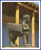 Yerevan, the ancient capital of Armenia, extends you a
warm and friendly welcome. It is one of the oldest cities in the
world. The earliest recorded settlement there dates back to 782 BC.
King Argishty I founded a fortress city in the north-eastern part
of present-day Yerevan, with the following cuneiform inscription,
“With the majesty of God Khald, Argishty, son of Menua, built
up this inaccessible castle and named it Erebuni…” You can
still see relics from this part of our history at the Erebuni
Museum in Yerevan.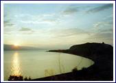
As you explore the many interesting sights in Yerevan, you will
learn about the culture and history of one of the world's
oldest nations.If you would like more information about Armenia, contact the
author of this article, Mr Mushegh Gevorgyan, who can assist with
tours, visas and translation services: tours@orient.am
-
Country Statistics: highest population density
Country tatistics: highest population density.
Rank
Country
Population
Area (km²)
Density
6,445,398,968
510,072,000
13
1
449,198
25.40
17,685
2
32,409
1.95
16,620
3
4,425,720
692.70
6,389
4
6,898,686
1,092
6,317
5
27,884
6.50
4,290
6
1,376,289
360
3,823
7
921
0.44
2,093
8
398,534
316
1,261
9
65,365
53.30
1,226
10
349,106
300
1,164
Source:
http://en.wikipedia.org/wiki/List_of_countries_by_population_density
-
Traveller's Diseases: Bird Flu
What is it: there are believed to be at least 15 different
types of avian flu that routinely infect birds around the world.
The current outbreak is caused by a strain known as H5N1, which is
highly contagious among birds and rapidly fatal. Unfortunately,
unlike many other strains of avian flu, it can be transmitted to
humans, causing severe illness and death.How do I get it: human cases have been blamed on direct
contact with infected chickens and their droppings. People who
catch the virus from birds can pass it on to other humans, although
the disease is generally milder in those who caught it from an
infected person rather than from birds.What happens if I get it: bird flu can cause a range of
symptoms in humans – some patients report fever, cough, sore throat
and muscle aches. Others suffer from eye infections, pneumonia,
acute respiratory distress and other severe and life-threatening
complications.Diagnose and treatment: flu drugs exist that may be used
both to prevent people from catching bird flu and to treat those
who have it. Currently there is no vaccine, although scientists are
working to develop one.How can I avoid contracting rabies: the World Health
Organization recommends that infected or exposed flocks of chickens
and other birds be killed in order to help prevent further spread
of the virus and reduce opportunities for human infection. However,
the agency warns that safety measures must be taken to prevent
exposure to the virus among workers involved in culling.
-
First Impressions by Sue Button
From 25,000 feet the view of the Tanzanian coastline with its coral
reefs, long sandy bays and azure blue sea looks like a classic
glossy travel brochure. And the 15-minute drive from Mtwara airport
reveals tantalising glimpses of the Indian Ocean between the exotic
display of palm and baobab trees. But as we enter Mikindani village
I'm looking more carefully at the scenery – for me this
isn't an exotic holiday destination; this is to be my home.I've already been advised that the first two weeks will be in
'Homestay' i.e. living with a local family, so I'm
interested to see what the local homes look like. I know that I
won't be staying in one of the daub and wattle huts, but in one
of the old stone houses. Sounds good. But the first stone houses
that we pass, although inhabited, appear to be in total ruin..? Becky introduces me to my host, Mr Sijaona. He is a
small wiry man with a purposeful stride. He welcomes me into his
house. I gaze around at the crumbling walls and the total lack of
comfort. But then he says in halting English that his other house
is better, (two wives, therefore two houses) – so I pick up my
suitcase and follow him down the dusty street.His other house is in a rather worse state of disrepair. The
ceiling of the front room is in a pile behind the door. I can't
see much detail, as the inside of the house is inky black after the
bright sunshine outside. He pulls aside an old piece of cloth to
show me to my quarters. I have arrived.I can't deny that during that first evening I wonder what on
earth I'm doing. Waves of panic alternate with interest, and
frustration. I want to ask a hundred questions; which is your wife
and who are all the other girls, children and women; what are we
going to eat for dinner and how is it prepared, how does the family
get water, how many people live in this house,…. but I
can't seem to make myself understood, or at least the answers
in halting English don't match my questions. I'm clutching
my 'Teach Yourself Swahili' but at this stage it might as
well be 'Astrophysics for Beginners'.By Day Four I'm beginning to make a bit more sense of my
surroundings. I've wandered around the Boma and its grounds,
visited a couple of schools, explored the village, the waterfront
and the yacht club, but more importantly had time to watch and chat
to local people. 'Chatting' takes the form of sign
language, my pathetic attempts at Swahili greetings, and local
people's various standards of English. Mr Sijaona and his
family are being wonderfully patient and helpful. I went with him
yesterday to water his garden and help him plant sweet potatoes.
Yesterday morning wife number 2 (you see, I am beginning to
find things out) sat with me for over an hour teaching me how to
plait grasses into a tape which forms the basis of a mat. And this
morning Mr Sijaona showed me how to weave a basket from palm
leaves.They are delighted to teach me these things and are willing me to
absorb the Swahili they keep throwing my way. If only I could
absorb it all quickly. But it's “Pole pole catchy
monkey”. I'll get there!